Integration Component
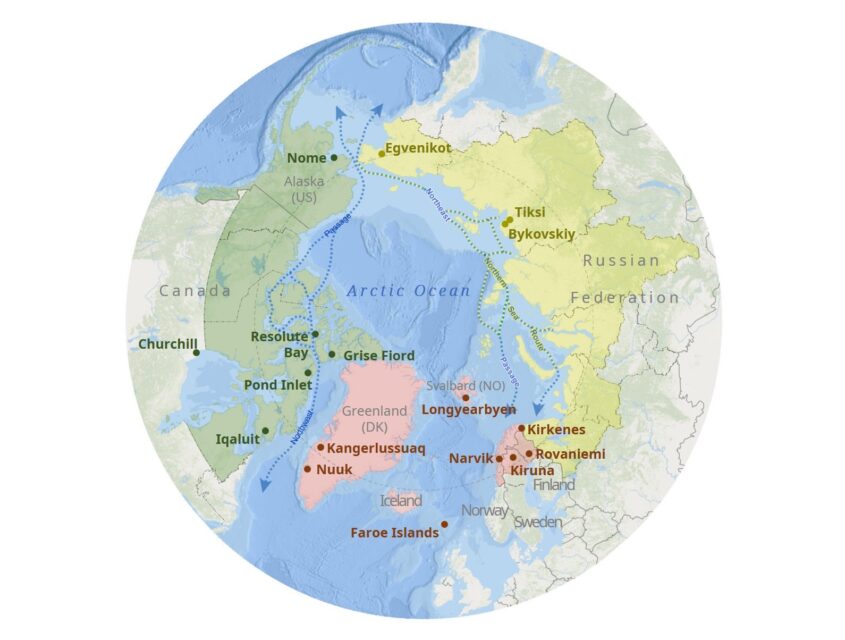
InfraNorth’s Integration Component (IC) constituted a cross-cutting methodological framework for the project and was managed by an interdisciplinary team of geographers and anthropologists. Its aim was to coordinate the research effort on what, when, and how the research would be conducted in the geographically, culturally, historically and politically diverse Arctic study regions of the project. To do so, the IC set up the main lines of comparison between field sites in the European and North American Arctic (see map). In case of the Russian Arctic, we used data collected before Russia’s invasion of Ukraine. Still, the ambition of the IC remained pan-Arctic.
Fieldwork
The IC provided methodological assistance for ethnographic fieldwork across a variety of heterogeneous Arctic field sites through a research protocol that combined qualitative and quantitative methods and drew on cross-cutting project activities. It coordinated shared thematic interviews, focus groups, and questionnaire surveys, all of which explored relationships between transport infrastructures and community well-being. Interviews and focus groups were interpreted within this broader ethnographic context. Questionnaires were filled out by local residents in situ or online and were analyzed and interpreted using statistics and Geographical Information Systems (GIS).
Scenario workshops
The conduct of scenario workshops was an important cross-cutting research activity coordinated by the IC. Local scenarios of possible futures (regarding transport infrastructures) were developed in collaboration with the research group on Cooperation and Transformative Governance (CAT) at the International Institute of Applied Systems Analysis (IIASA). In 2023, two scenario workshops were implemented with the assistance of local organizations and experts in Churchill, Manitoba and Kirkenes, Norway. The goal of these workshops was to spark and facilitate discussions about the future role of transport infrastructures for the well-being of these communities, incorporating the ideas and visions of local residents, experts, decision makers, and planners.
Outreach activities
The IC coordinated a variety of activities intended to disseminate the results of the project to a variety of audiences. One of them was a blog featuring project insights and data in an accessible and non-academic format. The output of the IC included other visual and cartographic representations of quantitative data as well. Charts and maps were used in internal discussions and scenario workshops, the media portal, and in other electronic and printed outreach products. Last but not least, scientific publications resulting from research and outreach activities were important products of the IC as well.